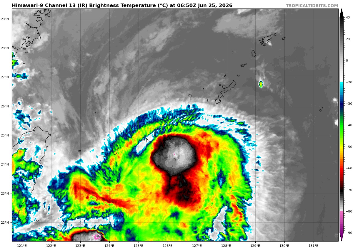
Information about this data

This page is updated every 15 minutes with the latest information on active storms and disturbances in all ocean basins from the Automated Tropical Cyclone Forecast system (ATCF). Note: while this information is official, it is issued at 6-hourly intervals (0z, 6z, 12z, and 18z) which fall in between the normal NHC full advisory times (3z, 9z, 15z, and 21z). Thus, the two sets of information may differ. Visit the National Hurricane Center or the Joint Typhoon Warning Center for the latest official storm status.


Invest 90S
As of 12:00 UTC Apr 27, 2024:

Location: 5.6°S 52.1°E
Maximum Winds: 15 kt  Gusts: N/A
Minimum Central Pressure: 1006 mb
Environmental Pressure: N/A
Radius of Circulation: N/A
Radius of Maximum wind: N/A
Infrared Satellite Image (click for loop): IR Satellite Image


Advertisement:
Surface Plot (click to enlarge): Note that the most recent hour may not be fully populated with stations yet.

Model Forecasts (list of model acronyms):
GFS Ensembles GEFS Forecast Tracks 00z  |  06z  |  12z  |  18z

Intensity Guidance Model Intensity Forecasts 00z  |  06z  |  12z  |  18z

Global + Hurricane Models Model Forecast Tracks 00z  |  06z  |  12z  |  18z

GEPS Ensembles GEPS Forecast Tracks 00z  |  12z